ZONING
Enrolment schemes are implemented when new schools are established in a community. The Ministry of Education is developing an enrolment scheme for Sir Douglas Bader Intermediate, which will be in effect for the beginning of term 1 in 2022.
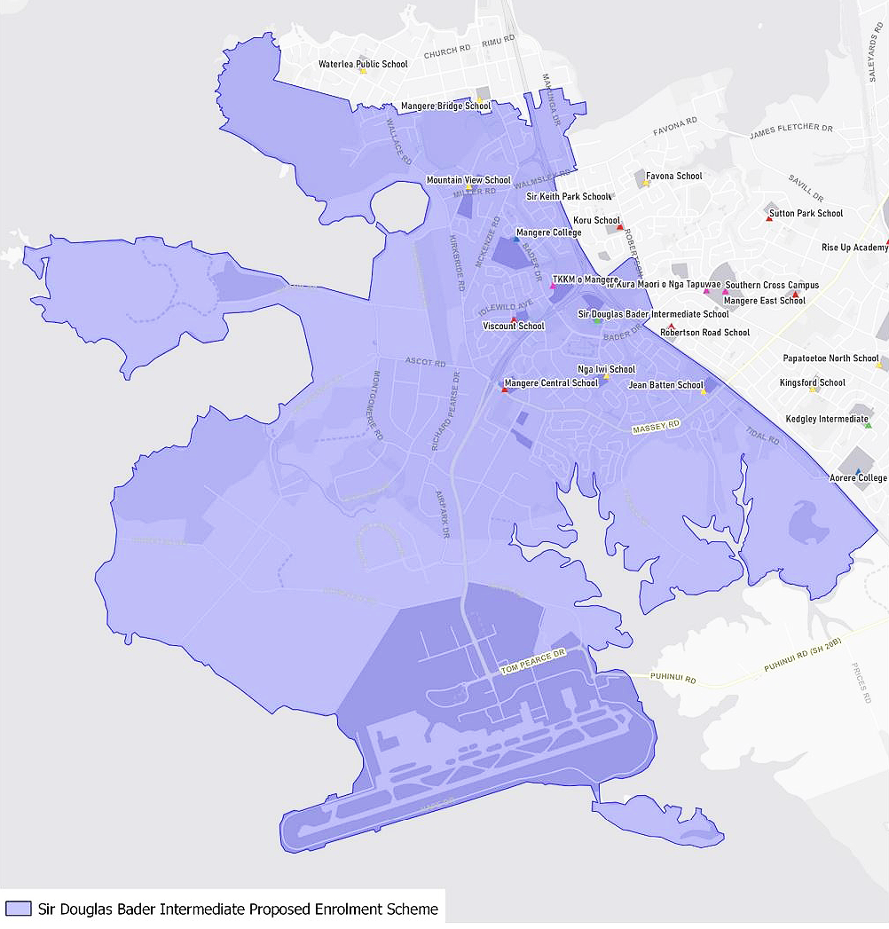
Having an enrolment scheme in place will ensure the Board of Trustees has a fair and transparent mechanism to manage the roll as it grows. The new enrolment scheme for Sir Douglas Bader Intermediate will have a home zone, like other schools with enrolment schemes in the area.
Children that live within this area will have the entitlement to enrol at Sir Douglas Bader Intermediate. The home zone area is shown on the map on the next page and includes: Beginning on the Southwestern Motorway (SH 20) across from the northern point of the Manukau Memorial Gardens Chapel, travel northwest along the motorway until Walmsley Road. Travel east along Walmsley Road (including odd address only) until Mahunga Drive. Travel north along Mahunga Drive (addresses 19-73 included, excluding Market Cove Road and Glasshouse Lane) until Hastie Avenue. Travel west along Hastie Avenue (excluded, Crawford Avenue, Domain Road, Domain Lane excluded) until the Mangere Domain. Travel west along the northern boundary of the domain until Ridgemount Rise (excluding Taylor Road and no exit roads along Taylor Road). Travel west along with Ridgemount Rise until Wallace Road and travel north along Wallace Road (excluding 45 and below odd addresses, 32 and below even addresses). Travel west along Matapouri Road and north along Purata Place until Purata Park. Travel west along Ambury Road (excluded) until the end of Ambury Road. Then travel north until the coastline, at which point the boundary follows the coastline (beginning westward) along the Manukau Harbour, including Puketutu Island and Wiroa Island, until the northern point of the Manukau Memorial Gardens Chapel.

